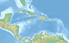
シャーロット・アマリー
合衆国領ヴァージン諸島の首都
シャーロット・アマリー(Charlotte Amalie)は、アメリカ合衆国の自治領であるアメリカ領ヴァージン諸島の首都。本島のセント・トーマス島にある。人口は1万0354人(2010年)。かつてはカリブ海の海賊の本拠地のひとつであったが、現在はカリブ海クルーズの拠点である。2004年には、約150万人のクルーズ客が上陸した。
| シャーロット・アマリー Charlotte Amalie | |
|---|---|

| |
| 位置 | |

| |
| 位置 | |

| |
| 座標 : 北緯18度21分0秒 西経64度57分0秒 / 北緯18.35000度 西経64.95000度 | |
| 行政 | |
| 国 | |
| 準州 | |
| 島 | セント・トーマス島 |
| 町 | シャーロット・アマリー |
| 地理 | |
| 面積 | |
| 町域 | 3.14 km2 |
| 人口 | |
| 人口 | (2010年4月1日現在) |
| 町域 | 10,354人 |
| 人口密度 | 3,297.5人/km2 |
| その他 | |
| ZIPコード | 00801–00804 |
| 市外局番 | 340 |
シャーロット・アマリーは北緯18度20分36秒 西経64度55分49秒 / 北緯18.34333度 西経64.93028度に位置している。
シャーロット・アマリーは数多くの歴史的建造物が残る歴史の町である。1672年にデンマーク西インド会社によって入植が始まり、1691年にデンマーク領ヴァージン諸島の首都に定められた。
1967年にヴァージン諸島を津波が襲った際、シャーロット・アマリーは大きな被害を受けた[1]。
第一次世界大戦下の1917年、アメリカ合衆国はパナマ運河防衛のためにヴァージン諸島をデンマークから購入した。1927年には住民にアメリカ合衆国市民権が与えられた。
西半球で2番目に長い歴史を持つシナゴーグであるセント・トーマス・シナゴーグ(St. Thomas Synagogue)もシャーロット・アマリーに立地している。市内の歴史的建造物や文化遺産は、セント・トーマス歴史トラスト(St. Thomas Historical Trust)によって守られている。また、シャーロット・アマリーには多数の免税店が建ち並び、観光客向けのショッピング・エリアにもなっている。
市名はデンマーク国王クリスチャン5世の王妃シャルロッテ・アマーリエ(1650年-1714年)にちなんで名付けられた。
気候
編集| シャーロット・アマリーの気候 | |||||||||||||
|---|---|---|---|---|---|---|---|---|---|---|---|---|---|
| 月 | 1月 | 2月 | 3月 | 4月 | 5月 | 6月 | 7月 | 8月 | 9月 | 10月 | 11月 | 12月 | 年 |
| 平均最高気温 °C (°F) | 30 (86) |
30 (86) |
30 (86) |
31 (88) |
31 (88) |
32 (90) |
32 (90) |
33 (91) |
32 (90) |
32 (90) |
31 (88) |
30 (86) |
31.2 (88.3) |
| 平均最低気温 °C (°F) | 22 (72) |
22 (72) |
22 (72) |
23 (74) |
24 (76) |
25 (77) |
26 (78) |
26 (78) |
25 (77) |
24 (76) |
24 (75) |
23 (73) |
23.8 (75) |
| 降水量 mm (inch) | 48 (1.89) |
38.4 (1.51) |
38.6 (1.52) |
60.7 (2.39) |
85.3 (3.36) |
59.7 (2.35) |
61.5 (2.42) |
88.9 (3.50) |
135.6 (5.34) |
141.5 (5.57) |
134.1 (5.28) |
69.6 (2.74) |
961.9 (37.87) |
| 出典:[2] | |||||||||||||
脚注
編集- ^ USC Tsunami Research Group. “The 1867 Virgin Island Tsunami”. The University of Southern California. 2015年10月3日閲覧。 “The first tsunami wave struck the town of Charlotte Amalie, on the island of St. Thomas, approximately 10 minutes after the first shock, and the second wave approximately 10 minutes after the second shock. Both waves struck the harbor at Charlotte Amalie first as a large recession of water, followed by a bore, which eyewitness accounts describe as a 4.5 to 6.1 meter wall of water. … The waves destroyed many small boats anchored in the harbor, leveled the town's iron warf, and either flooded out or destroyed all buildings located along the waterfront area.”
- ^ “Monthly Averages for Saint Thomas, VI (00801)”. The Weather Channel. May 13, 2009閲覧。


