日本語版

編集
並べて比較
{{Infobox Military Structure}}{{Infobox Military Structure/sandbox}}
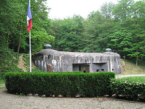
マジノ線
フランス東部
種類防衛線
施設情報
管理者フランス
歴史
建設1930年–40年
使用期間1935年–69年
建築資材コンクリート、鉄
使用戦争ナチス・ドイツのフランス侵攻
マジノ線
フランス東部
種類防衛線
施設情報
管理者フランス
歴史
建設1930年–40年
使用期間1935年–69年
建築資材コンクリート、鉄
使用戦争ナチス・ドイツのフランス侵攻
並べて比較
{{Infobox Military Structure}}{{Infobox Military Structure/sandbox}}
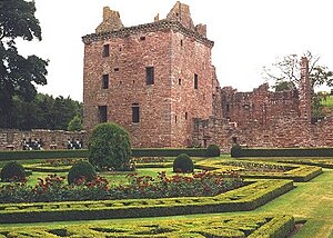
エドゼル城
スコットランドアンガスエドゼル (en近く
grid reference NO584691
エドゼル城と庭園
Infobox Military Structure/testcasesの位置(スコットランド内)
Infobox Military Structure/testcases
座標北緯56度49分 西経2度41分 / 北緯56.81度 西経2.68度 / 56.81; -2.68
種類城館・中庭
施設情報
所有者Earl of Dalhousieヒストリック・スコットランド (en
管理者エドゼルのリンゼイ家
一般公開一般公開中
現況荒廃
歴史
建設1520年-1610年
建設者David Lindsay, 9th Earl of Crawford
使用期間1715年まで
建築資材旧赤色砂岩
エドゼル城
スコットランドアンガスエドゼル (en近く
grid reference NO584691
エドゼル城と庭園
Infobox Military Structure/testcasesの位置(スコットランド内)
Infobox Military Structure/testcases
Scotland内の位置
座標北緯56度49分 西経2度41分 / 北緯56.81度 西経2.68度 / 56.81; -2.68
種類城館・中庭
施設情報
所有者Earl of Dalhousieヒストリック・スコットランド (en
管理者エドゼルのリンゼイ家
一般公開一般公開中
現況荒廃
歴史
建設1520年-1610年
建設者David Lindsay, 9th Earl of Crawford
使用期間1715年まで
建築資材旧赤色砂岩

Compatibility tests

編集

Infobox military structure

編集

Testcase 1

編集
並べて比較
{{Infobox Military Structure}}{{Infobox Military Structure/sandbox}}
Boden Fortress
Bodens fästning
Boden, Norrbotten, Sweden
Infobox Military Structure/testcasesの位置(スカンディナヴィア内)
Infobox Military Structure/testcases
Location of Boden Fortress
座標北緯65度49分48秒 東経21度41分24秒 / 北緯65.83000度 東経21.69000度 / 65.83000; 21.69000
種類Fortress
施設情報
所有者Government of Sweden
管理者Sweden
一般公開Yes, some parts
歴史
建設Complete fortress: 1900–1916
Main forts: 1901–1908
建設者Government of Sweden
使用期間1908–1998
建築資材Concrete, stone, steel
使用戦争None
駐屯情報
駐屯部隊Complete fortress: 15,000 men[1][note 1]
Main forts: 2,000 men[2]

Testcase 2

編集
並べて比較
{{Infobox Military Structure}}{{Infobox Military Structure/sandbox}}
RAF Holmpton
near Holmpton, East Riding of Yorkshire. England
The Guardroom at RAF Holmpton
Infobox Military Structure/testcasesの位置(イースト・ライディング・オブ・ヨークシャー内)
Infobox Military Structure/testcases
Location of RAF Holmpton
座標北緯53度41分02秒 東経0度04分02秒 / 北緯53.68389度 東経0.06722度 / 53.68389; 0.06722
種類RAF Command Bunker
地上高100 ft deep excavation
施設情報
管理者RAF Holmpton Preservation Society (RAFHPS)
一般公開Yes
現況Fully maintained
歴史
建設1951年 (1951)
使用期間1953–present
建築資材Concrete/steel/tungsten

Testcase 3

編集
並べて比較
{{Infobox Military Structure}}{{Infobox Military Structure/sandbox}}
March Air Reserve Base
Part of Air Force Reserve Command (AFRC)
Moreno Valley, California近く
A USAF C-17 Globemaster III from the 452d Air Mobility Wing takes off from nearby Riverside Municipal Airport, in March 2010.
Major Command
Infobox Military Structure/testcasesの位置(カリフォルニア州内)
Infobox Military Structure/testcases
Location of March Air Reserve Base
座標北緯33度52分50秒 西経117度15分34秒 / 北緯33.88056度 西経117.25944度 / 33.88056; -117.25944
施設情報
管理者 アメリカ空軍
現況Operational Air Force Reserve base
ウェブサイトwww.march.afrc.af.mil
歴史
建設1917年 (1917)
建設者Air Service, United States Army
使用戦争
World War I

World War II
駐屯情報
駐屯部隊 452d Air Mobility Wing
飛行場情報
識別子IATA: RIV、ICAO: KRIV、FAA LID: RIV
標高1,535メートル (5,036 ft) AMSL
滑走路
方向 全長・表面
14/32 13,300メートル (43,635 ft) Concrete
12/30 3,010メートル (9,875 ft) Concrete
March Air Reserve Base
Air Force Reserve Command (AFRC)の一部
Moreno Valley, California近く
A USAF C-17 Globemaster III from the 452d Air Mobility Wing takes off from nearby Riverside Municipal Airport, in March 2010.
Major Command
Infobox Military Structure/testcasesの位置(カリフォルニア州内)
Infobox Military Structure/testcases
Location of March Air Reserve Base
座標北緯33度52分50秒 西経117度15分34秒 / 北緯33.88056度 西経117.25944度 / 33.88056; -117.25944
施設情報
管理者 アメリカ空軍
現況Operational Air Force Reserve base
ウェブサイトwww.march.afrc.af.mil
歴史
建設1917年 (1917)
建設者Air Service, United States Army
使用戦争
World War I

World War II
駐屯情報
駐屯部隊 452d Air Mobility Wing
飛行場情報
識別子IATA: RIV、ICAO: KRIV、FAA LID: RIV
標高1,535メートル (5,036 ft) AMSL
滑走路
方向 全長・表面
14/32 13,300メートル (43,635 ft) Concrete
12/30 3,010メートル (9,875 ft) Concrete

Infobox military installation

編集

Testcase 1

編集
並べて比較
{{Infobox Military Structure}}{{Infobox Military Structure/sandbox}}
Nevada Test Site
Las Vegas近く the United States
November 1951 nuclear test at Nevada Test Site. Test is shot "Dog" from Operation Buster, with a yield of 21 kilotons. It was the first U.S. nuclear field exercise conducted on land; troops shown are a mere 6 miles from the blast.
The location of the site.
座標北緯37度07分 西経116度03分 / 北緯37.117度 西経116.050度 / 37.117; -116.050座標: 北緯37度07分 西経116度03分 / 北緯37.117度 西経116.050度 / 37.117; -116.050
種類Nuclear testing range
面積~1,350 mi² (~3,500 km²)
施設情報
運営者United States Department of Energy
状態Active
歴史
使用期間1951年 (1951)–present
実験情報
未臨界核実験1
実験2-925+
水爆実験3
45
浄化6
Nevada Test Site
the United StatesLas Vegas近く
November 1951 nuclear test at Nevada Test Site. Test is shot "Dog" from Operation Buster, with a yield of 21 kilotons. It was the first U.S. nuclear field exercise conducted on land; troops shown are a mere 6 miles from the blast.
The location of the site.
座標北緯37度07分 西経116度03分 / 北緯37.117度 西経116.050度 / 37.117; -116.050座標: 北緯37度07分 西経116度03分 / 北緯37.117度 西経116.050度 / 37.117; -116.050
種類Nuclear testing range
面積~1,350 mi² (~3,500 km²)
施設情報
運営者United States Department of Energy
状態Active
歴史
使用期間1951年 (1951)–present
実験情報
未臨界核実験1
実験2-925+
水爆実験3
45
浄化6

Testcase 2

編集
並べて比較
{{Infobox Military Structure}}{{Infobox Military Structure/sandbox}}
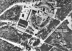
Peenemünde Army Research Center
Peenemunde近く Germany
Location in Germany
座標北緯54度08分34秒 東経13度47分38秒 / 北緯54.14278度 東経13.79389度 / 54.14278; 13.79389座標: 北緯54度08分34秒 東経13度47分38秒 / 北緯54.14278度 東経13.79389度 / 54.14278; 13.79389
種類Military proving ground
施設情報
運営者Nazi Germany
状態Peenemünde Historical and Technical Information Centre
歴史
使用期間1937-1945
Peenemünde Army Research Center
GermanyPeenemunde近く
Location in Germany
座標北緯54度08分34秒 東経13度47分38秒 / 北緯54.14278度 東経13.79389度 / 54.14278; 13.79389座標: 北緯54度08分34秒 東経13度47分38秒 / 北緯54.14278度 東経13.79389度 / 54.14278; 13.79389
種類Military proving ground
施設情報
運営者Nazi Germany
状態Peenemünde Historical and Technical Information Centre
歴史
使用期間1937-1945

Infobox airport

編集

Testcase 1

編集
RAF Brize Norton
Transire Confidenter
IATA: BZZICAO: EGVN
概要
空港種別Royal Air Force station
所有者Ministry of Defence
運営者Royal Air Force
所在地Carterton, Oxfordshire
建設1935年 (1935)
使用期間1937 - present
所在部隊
標高285 ft / 87 m
座標北緯51度45分00秒 西経001度35分01秒 / 北緯51.75000度 西経1.58361度 / 51.75000; -1.58361
ウェブサイト
地図
EGVNの位置(オックスフォードシャー内)
EGVN
EGVN
Location in Oxfordshire
滑走路
方向 全長 表面
ft m
08/26 10,007 3,050 Asphalt
RAF Brize Norton
Carterton, Oxfordshire近く
Transire Confidenter
Infobox Military Structure/testcasesの位置(オックスフォードシャー内)
Infobox Military Structure/testcases
Location in Oxfordshire
座標北緯51度45分00秒 西経001度35分01秒 / 北緯51.75000度 西経1.58361度 / 51.75000; -1.58361
種類Royal Air Force station
施設情報
所有者Ministry of Defence
運営者Royal Air Force
管理者RAF Air Command
ウェブサイトwww.raf.mod.uk/rafbrizenorton
歴史
建設1935年 (1935)
使用期間1937 - present
駐屯情報
現指揮官Group Captain Stephen F. Lushington ADC MA RAF [3]
使用者
飛行場情報
識別子IATA: BZZ、ICAO: EGVN
標高87メートル (285 ft) AMSL
滑走路
方向 全長・表面
08/26 10,007フィート (3,050 m) Asphalt

Testcase 2

編集
Wright Field
Wilbur Wright Field
Wilbur Wright Field, circa 1920
IATA: noneICAO: none
概要
空港種別Pilot training airfield (World War I)
Engineering and Development (World War II)
運営者  Air Service, United States Army
  United States Army Air Forces
所在地Riverside, Ohio, United States
建設1917年 (1917)
使用期間1917 - 1951
所在部隊Training Section, Air Service (World War I)
Army Air Force Materiel/Technical Service Command, (World War II)
標高791 ft / 241 m
座標北緯39度46分00秒 西経084度06分16秒 / 北緯39.76667度 西経84.10444度 / 39.76667; -84.10444座標: 北緯39度46分00秒 西経084度06分16秒 / 北緯39.76667度 西経84.10444度 / 39.76667; -84.10444
地図
Wright Fieldの位置(オハイオ州内)
Wright Field
Wright Field
Location in Ohio
Wright Field
Wilbur Wright Field
Riverside, Ohio, United States近く
Wilbur Wright Field, circa 1920
Infobox Military Structure/testcasesの位置(オハイオ州内)
Infobox Military Structure/testcases
Location in Ohio
座標北緯39度46分46秒 西経84度6分16秒 / 北緯39.77944度 西経84.10444度 / 39.77944; -84.10444 (Wright Field)
種類Pilot training airfield (World War I)
Engineering and Development (World War II)
施設情報
運営者  Air Service, United States Army
  United States Army Air Forces
現況National Museum of the United States Air Force
歴史
建設1917
使用期間1917–1951
使用戦争World War I
World War II
駐屯情報
駐屯部隊Training Section, Air Service (World War I)
Army Air Force Materiel/Technical Service Command, (World War II)
飛行場情報
標高791フィート (241 m) AMSL

Testcase 3

編集
CFB Suffield
IATA: noneICAO: CYSD
WMO: 71128
概要
空港種別Military
所有者Government of Canada
運営者Department of National Defence
所在地Cypress County, Alberta
建設1971
所在部隊Defence Research and Development Canada
British Army Training Unit Suffield
標高2,525 ft / 770 m
座標北緯50度16分24秒 西経111度10分30秒 / 北緯50.27333度 西経111.17500度 / 50.27333; -111.17500座標: 北緯50度16分24秒 西経111度10分30秒 / 北緯50.27333度 西経111.17500度 / 50.27333; -111.17500
ウェブサイト
地図
CYSDの位置(アルバータ州内)
CYSD
CYSD
Location in Alberta
ヘリパッド
番号 全長 表面
ft m
H1 130 x 375 40 x 110 Gravel
CFB Suffield
Cypress County, Alberta
Infobox Military Structure/testcasesの位置(アルバータ州内)
Infobox Military Structure/testcases
Location in Alberta
座標北緯50度16分24秒 西経111度10分30秒 / 北緯50.27333度 西経111.17500度 / 50.27333; -111.17500
種類Military
施設情報
所有者Government of Canada
管理者Department of National Defence
歴史
建設1971
使用期間1971–present
駐屯情報
現指揮官LCol R F Keller[6]
使用者Defence Research and Development Canada
British Army Training Unit Suffield
飛行場情報
識別子ICAO: CYSD
標高2,526フィート (770 m) AMSL
ヘリパッド
番号 全長・表面
H1 130 by 375フィート (40 m × 114 m) Gravel
Source: Canada Flight Supplement[4]
Environment Canada[7]

Testcase 4

編集
RAF Woodhall Spa
Avro Lancaster of 617 Squadron at Woodhall Spa
IATA: noneICAO: none
概要
空港種別Military
所有者Air Ministry
運営者Royal Air Force
所在地Tattershall Thorpe, Lincolnshire
建設1941年 (1941)
使用期間1942-1965年 (1965)
標高33 ft / 10 m
座標北緯53度07分54秒 西経0度11分04秒 / 北緯53.13167度 西経0.18444度 / 53.13167; -0.18444座標: 北緯53度07分54秒 西経0度11分04秒 / 北緯53.13167度 西経0.18444度 / 53.13167; -0.18444
地図
RAF Woodhall Spaの位置(リンカンシャー内)
RAF Woodhall Spa
RAF Woodhall Spa
Location in Lincolnshire
滑走路
方向 全長 表面
ft m
00/00 0 0 Asphalt
00/00 0 0 Asphalt
00/00 0 0 Asphalt
RAF Woodhall Spa
EnglandTattershall Thorpe, Lincolnshire,近く
Avro Lancaster of 617 Squadron at Woodhall Spa
Infobox Military Structure/testcasesの位置(リンカンシャー内)
Infobox Military Structure/testcases
Location in Lincolnshire
座標北緯53度07分54秒 西経000度11分04秒 / 北緯53.13167度 西経0.18444度 / 53.13167; -0.18444
種類Royal Air Force station
施設情報
所有者Air Ministry
運営者Royal Air Force
管理者RAF Bomber Command
歴史
建設1941年 (1941)
使用期間1942-1965年 (1965)
使用戦争Second World War
Cold War
駐屯情報
駐屯部隊No. 8 Group RAF
使用者
飛行場情報
標高10メートル (33 ft) AMSL
滑走路
方向 全長・表面
00/00 0メートル (0 ft) Asphalt

Testcase 5 Military Structure map params removed

編集
RAF Woodhall
Avro Lancaster of 617 Squadron at Woodhall Spa
IATA: noneICAO: none
概要
空港種別Military
所有者Air Ministry
運営者Royal Air Force
所在地Tattershall Thorpe, Lincolnshire
建設1941年 (1941)
使用期間1942-1965年 (1965)
標高33 ft / 10 m
座標北緯53度07分54秒 西経0度11分04秒 / 北緯53.13167度 西経0.18444度 / 53.13167; -0.18444座標: 北緯53度07分54秒 西経0度11分04秒 / 北緯53.13167度 西経0.18444度 / 53.13167; -0.18444
地図
RAF Woodhallの位置(リンカンシャー内)
RAF Woodhall
RAF Woodhall
Location in Lincolnshire
滑走路
方向 全長 表面
ft m
00/00 0 0 Asphalt
00/00 0 0 Asphalt
00/00 0 0 Asphalt
RAF Woodhall
EnglandTattershall Thorpe, Lincolnshire,近く
Avro Lancaster of 617 Squadron at Woodhall Spa
座標北緯53度07分55秒 西経0度11分02秒 / 北緯53.132度 西経0.184度 / 53.132; -0.184
種類Royal Air Force station
施設情報
所有者Air Ministry
運営者Royal Air Force
管理者RAF Bomber Command
歴史
建設1941年 (1941)
使用期間1942-1965年 (1965)
使用戦争Second World War
Cold War
駐屯情報
駐屯部隊No. 8 Group RAF
使用者
飛行場情報
標高10メートル (33 ft) AMSL
滑走路
方向 全長・表面
00/00 0メートル (0 ft) Asphalt

Examples for testing sandbox version

編集

Blank number test

編集
並べて比較
{{Infobox Military Structure}}{{Infobox Military Structure/sandbox}}
1
[[File:{{{62}}}|90px]]
2
Part of 3
4
5近く 6
[[File:{{{7}}}|250px|alt=8|8]]
9
[[File:{{{10}}}|75px|alt=11|11]]
12
座標13.5 CO-ORD'S
種類13
コード20
面積19
地上高25
施設情報
所有者14
運営者15
管理者16
一般公開34
現況27
1718
ウェブサイト35
歴史
建設21YYYY年 (YYYY)
建設者23
使用期間22構文エラー:「yyyy」を認識できません。 (YYYY)
建築資材24
現況26
使用戦争28
主な出来事29
駐屯情報
現指揮官30
元指揮官31
駐屯部隊32
使用者33
実験情報
未臨界核実験36
実験37
水爆実験38
3940
浄化41
[[File:{{{42}}}|250px|alt=43|43]]
44
飛行場情報
識別子IATA: 45、ICAO: 46、FAA LID: 47、TC LID: 48、LID: 49
標高52メートル (171 ft) AMSL
滑走路
方向 全長・表面
53 54メートル (177 ft) 55
ヘリパッド
番号 全長・表面
56 57メートル (187 ft) 58
5960
61
1
[[File:{{{62}}}|90px]]
2
3の一部
6・4
5近く
[[File:{{{7}}}|250px|alt=8|8]]
9
[[File:{{{10}}}|75px|alt=11|11]]
12
座標13.5 CO-ORD'S
種類13
コード20
面積19
地上高25
施設情報
所有者14
運営者15
管理者16
一般公開34
現況27
1718
ウェブサイト35
歴史
建設21YYYY年 (YYYY)
建設者23
使用期間22構文エラー:「yyyy」を認識できません。 (YYYY)
建築資材24
現況26
使用戦争28
主な出来事29
駐屯情報
現指揮官30
元指揮官31
駐屯部隊32
使用者33
実験情報
未臨界核実験36
実験37
水爆実験38
3940
浄化41
[[File:{{{42}}}|250px|alt=43|43]]
44
飛行場情報
識別子IATA: 45、ICAO: 46、FAA LID: 47、TC LID: 48、LID: 49
標高52メートル (171 ft) AMSL
滑走路
方向 全長・表面
53 54メートル (177 ft) 55
ヘリパッド
番号 全長・表面
56 57メートル (187 ft) 58
5960
61

RAF Brize Norton

編集
並べて比較
{{Infobox Military Structure}}{{Infobox Military Structure/sandbox}}
RAF Brize Norton
Brize Norton
Part of Military Training Area - South
Brize Norton, Oxfordshire, England
Carterton, Oxfordshire近く England
Station crest
A view of the hangars
座標OS TG2873114139
種類Royal Air Force station
コードdoesn't have one, that's a US thing
面積5 Sq miles
地上高100 ft (30 m)
施設情報
所有者Ministry of Defence
運営者RAF Air Command
管理者 イギリス空軍
一般公開No
状態Active / Intact
ウェブサイトRAF Brize Norton
歴史
建設1935年 (1935)-6
建設者J Laing & Son Ltd
使用期間1937 - present
建築資材Concrete, sand and iron
現況Intact
使用戦争Second World War
Falklands War
Iraq War
War in Afghanistan (2001–present)
主な出来事2003 Iraq War protestors
駐屯情報
現指揮官Group Captain Stephen F. Lushington ADC MA RAF
元指揮官Dave (2001-2003)
Dee (2003-2008)
Beakey (2009-2010)
駐屯部隊No. 2 Group RAF
使用者
飛行場情報
識別子IATA: ABC、ICAO: DE、FAA LID: FG、TC LID: HI、LID: JK
標高87メートル (285 ft) AMSL
滑走路
方向 全長・表面
01/20 4,000メートル (13,123 ft) Concrete
02/20 4,000メートル (13,123 ft) Asphalt
03/21 3,000メートル (9,843 ft) Concrete
04/22 3,000メートル (9,843 ft) Asphalt
05/23 2,000メートル (6,562 ft) Concrete
06/24 2,000メートル (6,562 ft) Asphalt
07/25 1,000メートル (3,281 ft) Concrete
08/26 500メートル (1,640 ft) Concrete
09/27 500メートル (1,640 ft) Asphalt
ヘリパッド
番号 全長・表面
H1 100 by 300フィート (30 m × 91 m) Concrete
H2 100 by 300フィート (30 m × 91 m) Asphalt
H3 100 by 300フィート (30 m × 91 m) Gravel
H4 200 by 600フィート (61 m × 183 m) Asphalt
H5 400 by 1,200フィート (120 m × 370 m) Concrete
H6 400 by 1,200フィート (120 m × 370 m) Asphalt
他の
飛行場施設
Rocket launching platforms:
1 - 300 ft - Concrete
Footnotes
RAF Brize Norton
Brize Norton
Military Training Area - Southの一部
England・Brize Norton, Oxfordshire, England
Carterton, Oxfordshire近く
Station crest
A view of the hangars
座標OS TG2873114139
種類Royal Air Force station
コードdoesn't have one, that's a US thing
面積5 Sq miles
地上高100 ft (30 m)
施設情報
所有者Ministry of Defence
運営者RAF Air Command
管理者 イギリス空軍
一般公開No
状態Active / Intact
ウェブサイトRAF Brize Norton
歴史
建設1935年 (1935)-6
建設者J Laing & Son Ltd
使用期間1937 - present
建築資材Concrete, sand and iron
現況Intact
使用戦争Second World War
Falklands War
Iraq War
War in Afghanistan (2001–present)
主な出来事2003 Iraq War protestors
駐屯情報
現指揮官Group Captain Stephen F. Lushington ADC MA RAF
元指揮官Dave (2001-2003)
Dee (2003-2008)
Beakey (2009-2010)
駐屯部隊No. 2 Group RAF
使用者
飛行場情報
識別子IATA: ABC、ICAO: DE、FAA LID: FG、TC LID: HI、LID: JK
標高87メートル (285 ft) AMSL
滑走路
方向 全長・表面
01/20 4,000メートル (13,123 ft) Concrete
02/20 4,000メートル (13,123 ft) Asphalt
03/21 3,000メートル (9,843 ft) Concrete
04/22 3,000メートル (9,843 ft) Asphalt
05/23 2,000メートル (6,562 ft) Concrete
06/24 2,000メートル (6,562 ft) Asphalt
07/25 1,000メートル (3,281 ft) Concrete
08/26 500メートル (1,640 ft) Concrete
09/27 500メートル (1,640 ft) Asphalt
ヘリパッド
番号 全長・表面
H1 100 by 300フィート (30 m × 91 m) Concrete
H2 100 by 300フィート (30 m × 91 m) Asphalt
H3 100 by 300フィート (30 m × 91 m) Gravel
H4 200 by 600フィート (61 m × 183 m) Asphalt
H5 400 by 1,200フィート (120 m × 370 m) Concrete
H6 400 by 1,200フィート (120 m × 370 m) Asphalt
他の
飛行場施設
Rocket launching platforms:
1 - 300 ft - Concrete
Footnotes

RNAS Pulham

編集
並べて比較
{{Infobox Military Structure}}{{Infobox Military Structure/sandbox}}
RNAS Pulham
Pulham St Mary
the R-33 RNAS Pulham circa 1921.
Infobox Military Structure/testcasesの位置(ノーフォーク内)
Infobox Military Structure/testcases
Location in Norfolk
座標北緯52度24分26秒 東経1度13分45秒 / 北緯52.40722度 東経1.22917度 / 52.40722; 1.22917
種類Airship station
施設情報
運営者Royal Navy, RAF
歴史
建設1915
使用期間1915 - 1948
飛行場情報
標高42メートル (138 ft) AMSL
Airship facilitiesairship hangars
mooring mast
{{Infobox military installation
|name         = RNAS Pulham
|image        = R-33 at mast 1921.JPG
|image-width  = <!--not used -->
|caption      = the R-33 RNAS Pulham circa 1921. 
|built        = 1915
|used         = 1915 - 1948
|type         = Airship station
|owner        = 
|operator     = [[Royal Navy]], [[イギリス空軍|RAF]]
|city-served  = <!--not used -->
|location     = [[Pulham St Mary]]
|elevation    = {{Convert|42|m|0}}
|latd=52 | latm=24 | lats=26  | latNS=N
|longd=1 | longm=13 | longs=45 | longEW=E
|coordinates_region = GB
|pushpin_map = United Kingdom Norfolk
|pushpin_label = RNAS Pulham
| pushpin_map_caption = Location in Norfolk
|website      = 
|footnotes    = 
<!--extras -->
|airfield_other_label=Airship facilities
|airfield_other=airship hangars<br>mooring mast
}}

Warwick Castle

編集
並べて比較
{{Infobox Military Structure}}{{Infobox Military Structure/sandbox}}
Warwick Castle
Warwick, Warwickshire
Warwick Castle and the River Avon
Infobox Military Structure/testcasesの位置(ウォリックシャー内)
Infobox Military Structure/testcases
Location in Warwickshire
座標北緯52度16分45秒 西経001度35分06秒 / 北緯52.27917度 西経1.58500度 / 52.27917; -1.58500座標: 北緯52度16分45秒 西経001度35分06秒 / 北緯52.27917度 西経1.58500度 / 52.27917; -1.58500
施設情報
所有者Merlin Entertainments
一般公開Yes
{{Infobox military installation
|name=Warwick Castle
|location=[[Warwick]], [[Warwickshire]]
|map_type=Warwickshire
|map_alt=Warwick Castle shown within Warwickshire
|coordinates={{Coord|52|16|45|N|001|35|06|W|region:GB_type:landmark|display=inline,title}}
|latd = 52 | latm = 16 | lats = 45 | latNS = N
|longd= 001 | longm= 35 | longs= 06 | longEW= W
|coordinates_type       = landmark
|coordinates_region     = GB
|pushpin_map            = United Kingdom Warwickshire
|pushpin_label          = Warwick Castle
|pushpin_map_caption    = Location in Warwickshire
|open_to_public=Yes
|ownership=[[Merlin Entertainments]]
|image=Warwickcastle Westside.jpg
|caption=Warwick Castle and the [[River Avon, Warwickshire|River Avon]]
}}

Woomera test range

編集
並べて比較
{{Infobox Military Structure}}{{Infobox Military Structure/sandbox}}
RAAF Woomera Test Range
Woomera, South Australia近く
A sign on the Stuart Highway indicating that vehicles are entering the Woomera test range, and are to stay on the road
Area currently covered by the Woomera test range
種類Aerospace (military/civil)
面積(vast)
施設情報
運営者Aerospace Operational Support Group RAAF
状態Active
歴史
使用期間1946–1980
1999–present
実験情報
実験See British nuclear tests at Maralinga
Range testingMissiles, aircraft weapons, drone aircraft, rockets
{{Infobox military structure
|name=RAAF Woomera Test Range
|image=Woomera-warning-sign.JPG
|caption=A sign on the [[Stuart Highway]] indicating that vehicles are entering the Woomera test range, and are to stay on the road
|map=[[File:Woomera Test Range map.svg|300px]]
|map_caption=Area currently covered by the Woomera test range
|type=Aerospace (military/civil)
|coordinates=
|nearest_town=[[Woomera, South Australia]]
|country=
|site_area= (vast)
|operator=[[Aerospace Operational Support Group RAAF]]
|status=Active
|dates=1946–1980<br />1999–present
|remediation=
|subcritical_tests=
|nuclear_tests=See [[British nuclear tests at Maralinga]]
|thermonuclear_tests=
|other_tests=Missiles, aircraft weapons, drone aircraft, rockets
|other_tests_label=Range testing

}}

References

編集

(A space for refs to end up if introduced/if needed)

  1. ^ Other sources mention other numbers; Hagerfors 2002 says that the five forts could accommodate up to 25,000 men, Nyström & Skeppstedt 1990, p. 220 says that calculations in 1926 put the wartime force in and around Boden at 16,521 men and Ericson Wolke 2009, p. 175 says no more than 12,000–13,000 men were stationed in the fortress during the Second World War.