モジュール:Location map/data/Russia Far Eastern Federal District
| 名称 | 極東連邦管区 | ||
|---|---|---|---|
| x | 50 + 143.2394488 * (1.623081485 - ($1 * 3.14159265358979 /180)) * sin(0.864926629 * ($2 + ($2<0)*360 - 140) *3.14159265358979 / 180)*0.862 | ||
| y | 50 - 143.2394488 * (0.575883933 - (1.623081485 - ($1*3.14159265358979 / 180)) * cos(0.864926629 * ($2 + ($2<0)*360 - 140) * 3.14159265358979 / 180)) | ||
| 画像 | Outline Map of Far Eastern Federal District.svg
| ||

| |||
| 画像1 | Relief Map of Far Eastern Federal District.jpg
| ||

| |||
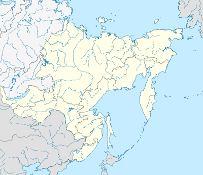
モジュール:Location map/data/Russia Far Eastern Federal Districtは極東連邦管区の正距円筒図法地図でオーバーレイのマーカー・ラベルを表示するのに使用する地点図のLuaモジュールです。マーカーは既定値の地図や同じような地図画像において緯度と経度の座標に基いて置かれます。
使用法
次のテンプレートで"Russia Far Eastern Federal District"というパラメータを使用します:
{{Location map | Russia Far Eastern Federal District | ...}}{{Location map many | Russia Far Eastern Federal District | ...}}{{Location map+ | Russia Far Eastern Federal District | ...}}{{Location map~ | Russia Far Eastern Federal District | ...}}
地図パラメータ
name = 極東連邦管区- モジュール名は地図説明文の既定値になります
image = Outline Map of Far Eastern Federal District.svg- 既定値の地図画像で"Image:"や"File:"は指定しません。
image1 = Relief Map of Far Eastern Federal District.jpg- 代替地図画像で、通常は地形図をreliefかAlternativeMapというパラメータで指定して表示します。
x = 50 + 143.2394488 * (1.623081485 - ($1 * 3.14159265358979 /180)) * sin(0.864926629 * ($2 + ($2<0)*360 - 140) *3.14159265358979 / 180)*0.862- 経度に基いて地図上の位置を計算する式で、最西端は0、最東端は100になります。
y = 50 - 143.2394488 * (0.575883933 - (1.623081485 - ($1*3.14159265358979 / 180)) * cos(0.864926629 * ($2 + ($2<0)*360 - 140) * 3.14159265358979 / 180))- 緯度に基いて地図上の位置を計算する式で、最北端は0、最南端は100になります。
代替地図
image1 (Relief Map of Far Eastern Federal District.jpg)で定義された地図は{{Location map}}、{{Location map many}}、{{Location map+}}といったテンプレートの「relief」か「AlternativeMap」のパラメータを使って表示できます。
これら2つのパラメータは以下の使用例で示しています。さらなる使用例は次のテンプレートにあります。:
関連項目
Location mapテンプレート
- Template:Location map - 緯度と経度を使って1つのマークとラベルを表示します。
- Template:Location map many - 9つまでのマークとラベルを表示します。
- Template:Location map+ - 無制限にマークとラベルを表示できます。
return {
	name = '極東連邦管区',
	y = '50 - 143.2394488 * (0.575883933 - (1.623081485 - ($1*3.14159265358979 / 180)) * cos(0.864926629 * ($2 + ($2<0)*360 - 140) * 3.14159265358979 / 180))',
	x = '50 + 143.2394488 * (1.623081485 - ($1 * 3.14159265358979 /180)) * sin(0.864926629 * ($2 + ($2<0)*360 - 140) *3.14159265358979 / 180)*0.862',
	image = 'Outline Map of Far Eastern Federal District.svg',
	image1 = 'Relief Map of Far Eastern Federal District.jpg'
}