ファイル:Nigeria 1960-1963.png
このプレビューのサイズ: 676 × 600 ピクセル。 その他の解像度: 271 × 240 ピクセル | 541 × 480 ピクセル | 866 × 768 ピクセル | 1,154 × 1,024 ピクセル | 1,869 × 1,658 ピクセル。
元のファイル (1,869 × 1,658 ピクセル、ファイルサイズ: 90キロバイト、MIME タイプ: image/png)
ウィキメディア・コモンズのファイルページにある説明を、以下に表示します。
|

|
このhistorical map画像は、ベクターイメージである SVG ファイルとして再作成されるべきです。これにはいくつかの利点があります。詳しくはCommons:Media for cleanupを参照してください。この画像の SVG 形式がすでに利用可能である場合は、アップロードしてください。アップロード後、この画像にあるこのテンプレートを{{Vector version available|新しい画像ファイル名.svg}}テンプレートで置き換えてください。
|
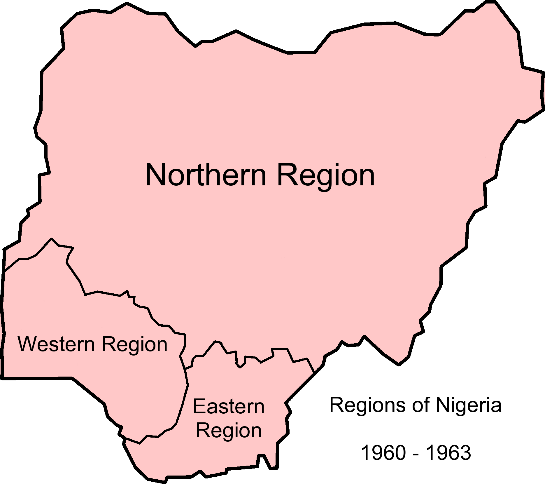
| 解説 | Map of Nigerian regions, 1960-1963. Info from http://www.statoids.com/ung.html, http://www.zum.de/whkmla/region/westafrica/nigeriaind.html and http://hdl.loc.gov/loc.gmd/g8840.ct003019 |
| 日付 | (UTC) |
| 原典 | |
| 作者 |
|
このファイルはクリエイティブ・コモンズ 表示-継承 3.0 非移植ライセンスのもとに利用を許諾されています。
- あなたは以下の条件に従う場合に限り、自由に
- 共有 – 本作品を複製、頒布、展示、実演できます。
- 再構成 – 二次的著作物を作成できます。
- あなたの従うべき条件は以下の通りです。
- 表示 – あなたは適切なクレジットを表示し、ライセンスへのリンクを提供し、変更があったらその旨を示さなければなりません。これらは合理的であればどのような方法で行っても構いませんが、許諾者があなたやあなたの利用行為を支持していると示唆するような方法は除きます。
- 継承 – もしあなたがこの作品をリミックスしたり、改変したり、加工した場合には、あなたはあなたの貢献部分を元の作品とこれと同一または互換性があるライセンスの下に頒布しなければなりません。
元のアップロードログ
This image is a derivative work of the following images:
- File:Nigeria_1963-1967.png licensed with Cc-by-sa-3.0-migrated, GFDL
- 2010-12-09T12:52:32Z StalwartUK 1869x1658 (103207 Bytes) {{Information |Description=Map of Nigerian regions, 1963-1967. Info from http://www.statoids.com/ung.html, http://www.zum.de/whkmla/region/westafrica/nigeriaind.html and http://hdl.loc.gov/loc.gmd/g8840.ct003019 |Source=*[[:F
- File:Nigeria_states-1967-1976.png licensed with Cc-by-sa-3.0-migrated, GFDL
- 2010-04-21T21:32:04Z Bejnar 1869x1658 (140363 Bytes) {{Information |Description=Map of Nigerian states, 1967 - 1976, from data from United States Geological Survey, Africa Data Dissemination Service. |Source=*[[:File:Nigeria_states-1976-1987.png|]] |Date=2010-04-21 21:30 (UTC)
Uploaded with derivativeFX
ファイルの履歴
過去の版のファイルを表示するには、その版の日時をクリックしてください。
| 日付と時刻 | サムネイル | 寸法 | 利用者 | コメント | |
|---|---|---|---|---|---|
| 現在の版 | 2010年12月9日 (木) 12:57 | | 1,869 × 1,658 (90キロバイト) | StalwartUK | {{Information |Description=Map of Nigerian regions, 1960-1963. Info from http://www.statoids.com/ung.html, http://www.zum.de/whkmla/region/westafrica/nigeriaind.html and http://hdl.loc.gov/loc.gmd/g8840.ct003019 |Source=*File:Nigeria_1963-1967.png * |
ファイルの使用状況
以下の 2 ページがこのファイルを使用しています:
グローバルなファイル使用状況
以下に挙げる他のウィキがこの画像を使っています:
- bn.wikipedia.org での使用状況
- ca.wikipedia.org での使用状況
- de.wikipedia.org での使用状況
- en.wikipedia.org での使用状況
- eo.wikipedia.org での使用状況
- es.wikipedia.org での使用状況
- et.wikipedia.org での使用状況
- ha.wikipedia.org での使用状況
- hy.wikipedia.org での使用状況
- incubator.wikimedia.org での使用状況
- vi.wikipedia.org での使用状況
- zh.wikipedia.org での使用状況