ファイル:Macau topographic map-fr animated.gif

このプレビューのサイズ: 511 × 599 ピクセル。 その他の解像度: 205 × 240 ピクセル | 409 × 480 ピクセル | 694 × 814 ピクセル。
元のファイル (694 × 814 ピクセル、ファイルサイズ: 615キロバイト、MIME タイプ: image/gif、ループします、7 フレーム、21秒)
ウィキメディア・コモンズのファイルページにある説明を、以下に表示します。
|
| 解説 |
Français : Carte topographique et administrative en français de Macao, avec l'évolution depuis l'arrivée des Portugais entre 1554 et 1557, jusqu'en 2004. Deutsch: Topographische Karte / Verwaltungskarte zum Macao, in Französische English: Topographic and administrative map in French of Macau Español: Mapa topográfico y administrativo en francès de Macao Italiano: Carta topografica e amministrativa de Macao 日本語:フランス語で表示したマカオの地形·行政地図 Português: Carta topográfica e da administração do Macau em francês |
||||
| 日付 | 05/10/2010 (10 mai 2010) | ||||
| 原典 |
Français : Création personnelle ;
English: Own work ;
|
||||
| 作者 | Bourrichon - fr:Bourrichon | ||||
| 許可 (ファイルの再利用) |
この作品の著作権者である私は、この作品を以下のライセンスで提供します。
あなたは上記のライセンスから、どれか一つ以上を選択できます。 |
||||
| その他のバージョン |
[]
|


ファイルの履歴
過去の版のファイルを表示するには、その版の日時をクリックしてください。
| 日付と時刻 | サムネイル | 寸法 | 利用者 | コメント | |
|---|---|---|---|---|---|
| 現在の版 | 2011年2月25日 (金) 08:56 | | 694 × 814(615キロバイト) | Bourrichon | petite correction |
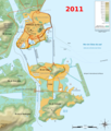
| 2011年2月24日 (木) 20:13 |  | 694 × 814(615キロバイト) | Bourrichon | + petite extension portuaire | |
| 2011年2月24日 (木) 19:59 |  | 694 × 814(613キロバイト) | Bourrichon | Quelques corrections | |
| 2010年5月9日 (日) 19:38 |  | 694 × 814(610キロバイト) | Bourrichon | +2010 | |
| 2010年5月9日 (日) 17:23 |  | 694 × 814(506キロバイト) | Bourrichon | {{Information |Description= {{fr|Carte topographique et administrative en français de Macao, avec l'évolution depuis l'arrivée des Portugais entre 1554 et 1557.}}{{de|Topographische Karte / Verwaltungskarte zum Macao, in Fra |
ファイルの使用状況
以下のページがこのファイルを使用しています:
グローバルなファイル使用状況
以下に挙げる他のウィキがこの画像を使っています:
- cs.wikipedia.org での使用状況
- en.wikipedia.org での使用状況
- fr.wikipedia.org での使用状況
- ru.wikipedia.org での使用状況
- zh.wikipedia.org での使用状況