ファイル:Kansaspacificgrants.jpg

このプレビューのサイズ: 800 × 527 ピクセル。 その他の解像度: 320 × 211 ピクセル | 640 × 422 ピクセル | 1,024 × 675 ピクセル | 1,280 × 844 ピクセル | 2,560 × 1,688 ピクセル | 5,304 × 3,497 ピクセル。
元のファイル (5,304 × 3,497 ピクセル、ファイルサイズ: 2.71メガバイト、MIME タイプ: image/jpeg)
ファイルの履歴
過去の版のファイルを表示するには、その版の日時をクリックしてください。
| 日付と時刻 | サムネイル | 寸法 | 利用者 | コメント | |
|---|---|---|---|---|---|
| 現在の版 | 2013年7月22日 (月) 15:51 |  | 5,304 × 3,497 (2.71メガバイト) | Liesel | greater version |
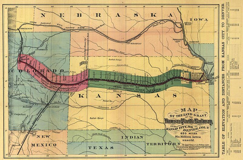
| 2005年3月13日 (日) 08:55 |  | 640 × 438 (70キロバイト) | Decumanus~commonswiki | Historic map of the Kansas Pacific Railway lines in the western U.S. |
ファイルの使用状況
以下のページがこのファイルを使用しています:
グローバルなファイル使用状況
以下に挙げる他のウィキがこの画像を使っています:
- de.wikipedia.org での使用状況
- en.wikipedia.org での使用状況
- es.wikipedia.org での使用状況
- fi.wikipedia.org での使用状況
- fr.wikipedia.org での使用状況
- hu.wikipedia.org での使用状況
- no.wikipedia.org での使用状況
- simple.wikipedia.org での使用状況
- www.wikidata.org での使用状況


