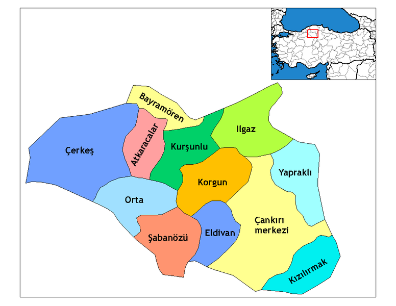
ファイル:Çankırı districts.png

このプレビューのサイズ: 776 × 600 ピクセル。 その他の解像度: 311 × 240 ピクセル | 621 × 480 ピクセル | 994 × 768 ピクセル | 1,056 × 816 ピクセル。
元のファイル (1,056 × 816 ピクセル、ファイルサイズ: 37キロバイト、MIME タイプ: image/png)
ファイルの履歴
過去の版のファイルを表示するには、その版の日時をクリックしてください。
| 日付と時刻 | サムネイル | 寸法 | 利用者 | コメント | |
|---|---|---|---|---|---|
| 現在の版 | 2008年12月28日 (日) 21:46 |  | 1,056 × 816 (37キロバイト) | One Homo Sapiens | Corrected text where İ,Ş,ı,ğ,or ş occurs in name. Source: [statoids-com]. Increased font size and enhanced color differences among adjacent districts. |
| 2007年3月31日 (土) 07:14 |  | 1,056 × 816 (30キロバイト) | Denizz~commonswiki | == Summary == Map of the districts of Cankiri province in Turkey. Created by Rarelibra 19:28, 1 December 2006 (UTC) for public domain use, using MapInfo Professional v8.5 and various mapping resources. == Licensing == {{PD-self}} <!-- |
ファイルの使用状況
グローバルなファイル使用状況
以下に挙げる他のウィキがこの画像を使っています:
- ar.wikipedia.org での使用状況
- ast.wikipedia.org での使用状況
- ba.wikipedia.org での使用状況
- ca.wikipedia.org での使用状況
- cs.wikipedia.org での使用状況
- de.wikipedia.org での使用状況
- diq.wikipedia.org での使用状況
- en.wikipedia.org での使用状況
- Çankırı Province
- Wikipedia:Reference desk/Archives/Science/2009 December 25
- Districts of Turkey
- Governor of Çankırı
- List of populated places in Çankırı Province
- Orta District
- Atkaracalar District
- Bayramören District
- Çankırı District
- Çerkeş District
- Eldivan District
- Ilgaz District
- Kızılırmak District
- Korgun District
- Kurşunlu District
- Şabanözü District
- Yapraklı District
- en.wiktionary.org での使用状況
- eo.wikipedia.org での使用状況
- es.wikipedia.org での使用状況
- eu.wikipedia.org での使用状況
- fa.wikipedia.org での使用状況
このファイルのグローバル使用状況を表示する。